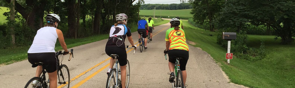
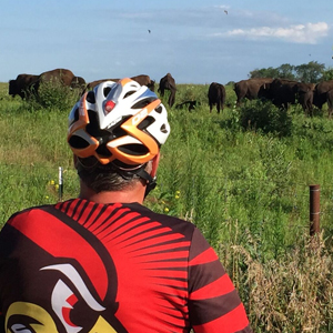
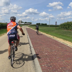
If you like biking, then you are going to LOVE Oregon! As the trail-head to a wide variety of rides, we welcome you to experience the quiet roads and the prettiest views in Northern Illinois. Routes include historic sites, river views, rolling fields, lush woods, quaint towns, and even a herd of bison! So why go farther? Bike Ogle; and enjoy what we have to offer you.
Doesn’t sound like the Illinois you know? Seeing is believing.
Check out our drone footage of biking in Ogle County: click here
Like Bike Ogle on Facebook for many more photos and activities.
Mobile ready interactive map app. Take a look HERE.
WARMSHOWERS!
Oregon currently has 4 Warmshower hosts for cyclists traveling long distances and looking for friendly accommodations. Be sure to check them out if you are passing near the area on a long ride… Learn more about this hospitality exchange for touring cyclists at: warmshowers.org
Annual: T.O.S.O.C. “Tour of Scenic Ogle County”
 T.O.S.O.C INFORMATION
Join us on the TOSOC – Tour of Scenic Ogle County – passing through some of the most beautiful roads in Northern Illinois. Routes are on quiet, paved country roads with rolling hills, passing beautiful scenery on well-marked routes. Highlight includes ride past Nachusa Grasslands with its herd of 100+ Bison in a natural habitat. All rides start at the Village of Progress at 710 South 13th Street in Oregon, Illinois. To register, click here .
Merchandise includes long sleeve TOSOC t’s and TOSOC socks
All 3 rides start at the Village of Progress at 710 South 13th Street in Oregon, IL. Choose a 10 mile, 32 mile, or a 62 miles route – NO GRAVEL.
This is a fundraiser for the Village of Progress, a non-profit providing training opportunities for individuals with developmental disabilities.
Years of success! Each year has seen 275 – 350 participants, many returning for their 3rd, 4th (or more) rides. Each year has raised $10,000 – $12,000 for services to adults with disabilities. Thank you for your support!
Cycling Trail-head / Historic Depot:
The Historic Train Depot in Oregon hosts a viewing platform and serves as the trailhead for Ogle County bike loops. The curved steel trestles and roof were built and put in place by local metal fabrication industries. It also includes a bike fix-it stand with air pump and frequently used tools for any last-minute adjustments you may need to make. An information stand provides route information and brochures for area towns and attractions. Plenty of parking is available.
COMMUNITY BIKE TRAIL
This bike route through the quiet neighborhoods of Oregon is marked with easy-to-follow signage. The loop visits most city parks and provides great access to shopping and points of interest. The Community Bike Trail is an easy casual ride for individuals and families looking for a bit of relaxation on any day of the week. Download the Community Bike Trail Map 2023 to plan your ride!
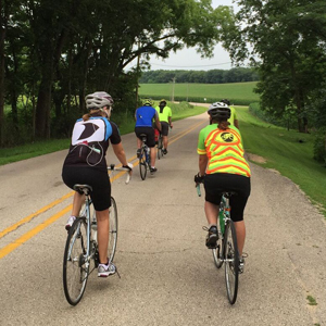
BIKE OGLE BIKE ROUTES
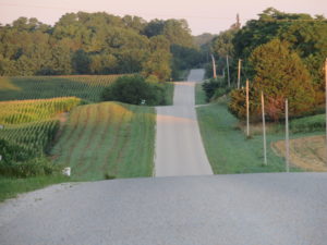
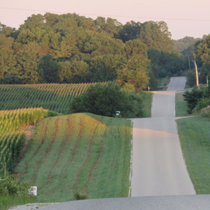
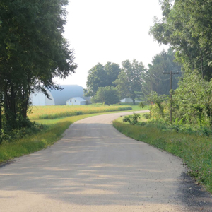
This is a listing of pre-planned routes on the back roads through Ogle County. Each has a printable brochure with map and points of interest as well as a link to “Ride with GPS” interactive maps. A ride can begin at any point on each loop… so feel free to start in any of Ogle county’s quaint communities. Enjoy!
 NACHUSA BISON – JOHN DEERE LOOP
BROCHURE/MAP
RIDE WITH GPS
32.4 Miles
The signature ride of the described loops. This relatively short ride takes you twice across the Rock River, past grasslands with free ranging bison, and by the small historical village of Grand Detour – the pioneer home of John Deere where he invented the modern plow in 1837.
 BISON – REAGAN – JOHN DEERE LOOP
BROCHURE/MAP
RIDE WITH GPS
39.4 Miles
Similar to above but adds Dixon and Reagan sites. Wide rolling hills with a couple of good climbs. Typically, on low traffic country roads, but some county highways with good visibility.
Highlights include the Nachusa Grasslands with spectacular views, hiking and view of bison herd; Dixon riverfront and downtown, with interesting shops and restaurants as well as Reagan information; John Deere Historical Site, with active smithy and historical displays. Great variety of views and rural environments.
 BYRON – NUCLEAR LOOP
BROCHURE/MAP
RIDE WITH GPS
24 Miles
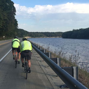
Largely flat and fast. A nice little morning or afternoon ride. Spectacular views and rest stops along the Rock River. State highway 2 provides very wide shoulders which often used by cyclists between Oregon and Byron.
Side trip to the Byron Forest Preserve is a steep climb, but you are rewarded with a great view and award-winning interpretive center. The ride finishes along flat and fast country roads which pass just next to the nuclear plant cooling towers, an awesome sight. A couple of short side trips near the end of this loop can take you to the Black Hawk Statue at Lowden State Park as well as Oregon Park East along the river spillway.
 FORRESTON – MT. MORRIS LOOP
BROCHURE/MAP
RIDE WITH GPS
45.5 Miles
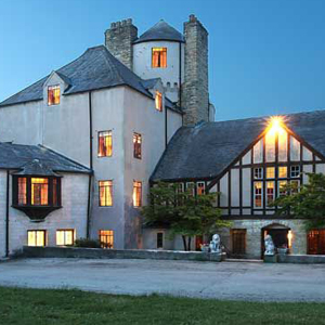
This is a long loop, but one with a great riding experience. Almost entirely on low traffic country roads, it begins along the Rock River, travels a bit through wooded hills and curves, then straightens out for a largely flat and fast ride through the open country. …and a short optional side trip to the Stronghold Castle!
A favorite ride of many. Takes you through two small communities worth a ride around; both providing opportunities for food and drink. Always nice to finish with a ride through Oregon’s Park West.
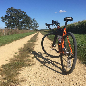 GRAVEL, CHIP, HILL, & ROCK RIVER LOOP
BROCHURE/MAP
RIDE WITH GPS
43.2 Miles
The toughest ride of the bunch, designed with the more adventuresome cyclist in mind. Gravel roads, deep countryside valleys, a lot of hills and a lot of miles.
A great conditioning ride when getting in shape for just about any type of cycling competition. Experience the country up close and personal. Able to see things few others know are there.
 ROCK RIVER – WEST GROVE – MT. MORRIS LOOP
BROCHURE/MAP
RIDE WITH GPS
26.3 Miles
A nice shorter loop through a wide variety of scenery. Similar to the Forreston loop, but fewer miles.
Consider a short gravel ride up the hill to Stronghold Church Camp, site of Stronghold Castle. The ride then takes you along the Rock River, through wooded hills, then open fields. West Grove Rd. is considered one of nicest in the county. The ride finishes through historic Mt. Morris and then the roller coaster hills of Oregon Trail Road. Enjoy.
 PAYNES POINT – STILLMAN LOOP
BROCHURE/MAP
RIDE WITH GPS
29.7 Miles
With the exception of a short steep hill to get you above the Rock River valley, this loop provides a great ride through slightly rolling countryside. The views across the miles-wide shallow valleys are unmatched in grandeur.
And as a bonus, this loop takes you by a little known, but somber historical site in Stillman Valley which records the first battle of the Blackhawk Indian War in 1832. The Chicago Blackhawks take their name from this Indian warrior who unsuccessfully attempted to return his tribe to its native lands. Many other references to this man continue in today’s culture, but few people have a true understanding of their origin.
 POLO – MT. MORRIS LOOP
BROCHURE/MAP
RIDE WITH GPS
40.1 Miles
This loop captures the countryside of western Ogle County: wide and deep valleys and more woods and pastures than typical of the east side of the Rock.
You travel through two very pleasant rural communities with interesting history and buildings as well as shops, food and drink. Take note of where the Stengel Bike Trail starts in Polo, and consider it as an add-on or for a return trip.
 ROCHELLE – CHANA LOOP
BROCHURE/MAP
RIDE WITH GPS
42.3 Miles
One of the longer, yet easier loops to ride. This route stays on lightly traveled roads in the eastern half of the county and as a result has very few hills. Yet it encounters some very interesting landscapes, communities, and history. The ride is flat and fast, but with good points of interest.
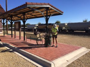
Rochelle is at the turnaround point. An easy 1/2 mile turn to the left on Flagg Rd. provides the interested cyclist with a few extra miles if they wish to explore the town’s community bike trails, skydiving club, and acclaimed rail viewing station. This would truly provide a full day experience.
Joe Stengel Trail (Polo-Woosung)
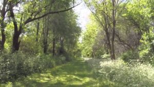 The Joe Stengel Trail follows an old railroad corridor for 7 miles between the town of Polo and the much smaller community of Woosung. The trail corridor traces farm country along a route scattered with trees. The natural surface can be rough going in places. In Polo the trail follows city streets, ending at a small cemetery north of town. http://www.traillink.com/trail/joe-stengel-trail.aspx